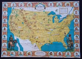
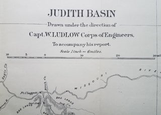
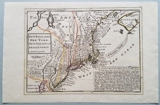
The Virgin Islands from English and Danish Surveys, by Thomas Jefferys, Geographer to the King...
[London]: Published by Laurie & Whittle. No. 53 in Fleet Street, as the Act directs. 1797. Image size: 18 3/8 x 24." Sheet size: 21 x 28 ¾.”. This classic map of the Virgin Islands appeared in Thomas Jefferys' West India Atlas; the first issue of the chart was dated..... More


![Item #3784 Chart of the Gulf Stream [appearing in] The American Museum: or Repository of Ancient...](https://bickerstaffs.cdn.bibliopolis.com/pictures/3784.jpg?width=320&height=427&fit=bounds&auto=webp&v=1733613234)

![Item #3777 Jabberwocky Re-versed and other Guinness Versions. [with] Alice Aforethought. Guinness...](https://bickerstaffs.cdn.bibliopolis.com/pictures/3777.jpg?width=320&height=427&fit=bounds&auto=webp&v=1679010758)

![Item #3770 Newsmap, Monday, 21 August 1944. [With map of] Philippine Islands. World War II.,...](https://bickerstaffs.cdn.bibliopolis.com/pictures/3770.jpg?width=320&height=427&fit=bounds&auto=webp&v=1668385363)