


![Item #3770 Newsmap, Monday, 21 August 1944. [With map of] Philippine Islands. World War II., Army Information Branch U S. Army.](https://bickerstaffs.cdn.bibliopolis.com/pictures/3770.jpg?width=768&height=1000&fit=bounds&auto=webp&v=1668385363)
![Newsmap, Monday, 21 August 1944. [With map of] Philippine Islands.](https://bickerstaffs.cdn.bibliopolis.com/pictures/3770_2.jpg?auto=webp&v=1668385363)
![Newsmap, Monday, 21 August 1944. [With map of] Philippine Islands.](https://bickerstaffs.cdn.bibliopolis.com/pictures/3770_3.jpg?auto=webp&v=1668385363)
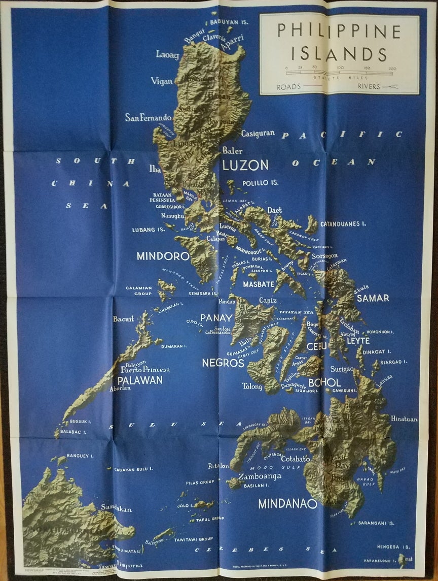
Newsmap, Monday, 21 August 1944. [With map of] Philippine Islands.
New York: U.S. Army, 1944. Sheet size: about 47 x 35,” folding to 8 ¾ x 11 ¾.” Folded as issued. Some soiling; a few minor breaks at fold intersections. Item #3770
Newsmap was a poster/newspaper issued weekly during World War II by the U.S. War Department to military installations and government and civic groups working on War Department projects. Issues generally contained one or more maps as well as reports of recent military actions. A good overview of the history and content of the Newsmaps is provided by the University of North Texas Digital Library. https://digital.library.unt.edu/explore/collections/NMAP/
This issue features a large and dramatic map of the Philippine Islands. The reverse has two additional maps: Southern France, and an untitled map of the Pacific and Indian Oceans.
Reference: Not in David Rumsey Historical Map Collection.
[ICN 7729.3.].
Price: $295.00