


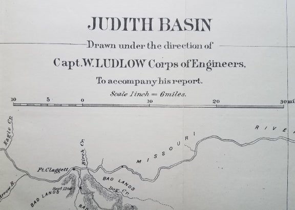
Judith Basin: Drawn under the direction of Capt. W. Ludlow Corps of Engineers.
[Washington, DC.]: [Government Printing Office.], 1876. 17 ¼ x 12.”. Very good. Folded as issued. Minor short tears at edges. Item #3756
This map provides detail of the Judith Basin area included in Capt. William Ludlow’s map from Carroll, Montana to Yellowstone Park in the summer of 1875.
The map identifies Judith River, Judith Mountains, Snowy Mountains and Fort Clagett. In addition to showing the route of Ludlow’s expedition, the map includes the routes of previous expeditions: Lt. Mullins (1860), Capt. Clift (1869) and Capt. Williams (1874).
The map appeared in Report of a Reconnaissance From Carroll, Montana Territory, on the Upper Missouri, to the Yellowstone National Park, and Return Made in the Summer of 1875, by William Ludlow, published in 1876 (which is not included with the map).
Reference: Wheat, Mapping the Transmississippi West: 1259.
[ICN 7428.1-b].
Price: $175.00