


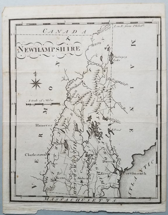
Newhampshire.
Philadelphia: From Scott's The United States Gazetteer... 1795. 7 ½ x 6 ¼." A strong impression. Very good with original fold lines. Very minor staining. Item #3771
Scott's The United States Gazetteer was the first gazetteer printed in the U.S. It included maps of the individual states. This five-county map of New Hampshire from the Gazetteer identifies nine towns, “the White Hills,” main roads, and major rivers and lakes. The notation "42,000 Acres to Dartmouth College" appears at the northern tip of the state.
The map appeared the following year (1796) – with very minor changes – in Scott’s An Atlas of the United States.
An early New Hampshire map, one of the first five maps of the State published in America.
References: Wheat & Brun, Maps & Charts Published in America before 1800: 186. Cobb, New Hampshire Maps to 1900: 72. David Rumsey Map Collection: List no. 0887.010.
[Item no. 7751.].
Price: $200.00