


St. Croix Island 1604.
[Eastport, ME]: The Tides Institute & Museum of Arts, 2010. Item #3758
Sheet size: 14 x 22.” Map dimensions: about 10 x 13.” Printed on heavy stock. Fine.
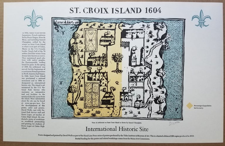
This striking 2010 map of the 1604 settlement on the island of St. Croix off Calais, Maine was designed and printed by David Wolfe, noted Portland, Maine printer. It was part of the Hand Line Press series of posters produced by the Tides Institute in Eastport.
The map was created using woodcut and letterpress. It is an artistic rendering of Champlain’s map, Habitation de L’Isle Ste Croix, which appeared in his Voyages, published in Paris in 1613. The note at the lower right of the image area explains that the yellow shading on the western portion of the map denotes "Percentage of population lost to scurvy."
David Wolfe has signed in pencil beneath the lower right corner of the map.
The map notes an edition limit of 250 copies. No examples appear on OCLC.
[ICN 7699.3].
Price: $295.00