


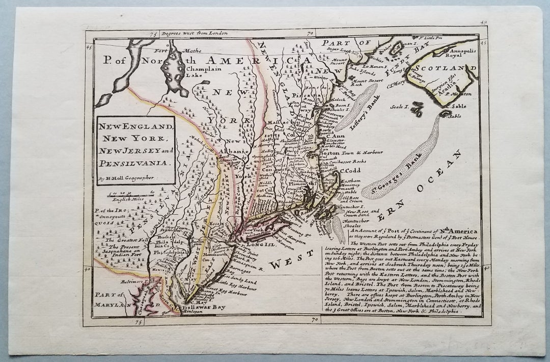
New England, New York, New Jersey, and Pensilvania. By H. Moll Geographer.
[London.]: From Moll's Atlas Minor, 1729 or later. 7 7/8 x 10 3/4." A good impression. Outline color of colonies. A few unobtrusive light stains. Overall, near fine. Item #3773
A wonderful early portrayal of the present-day northeastern United States from Grand Manan Island to the Delaware Bay. It is an updated and slightly larger version of Moll's 1708 map of the same title. Cape Cod is oddly shaped and Nantucket is styled "Nantucher I." New Jersey is shown as East Jersey and West Jersey. "Sugar Loafe hill" appears just west of Machias on the Maine coast.
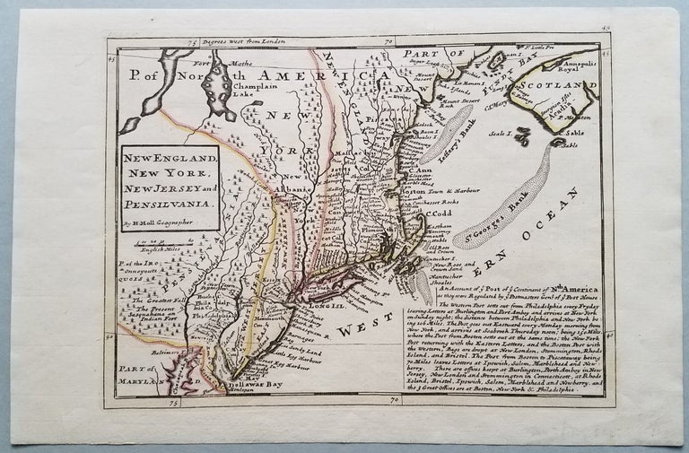
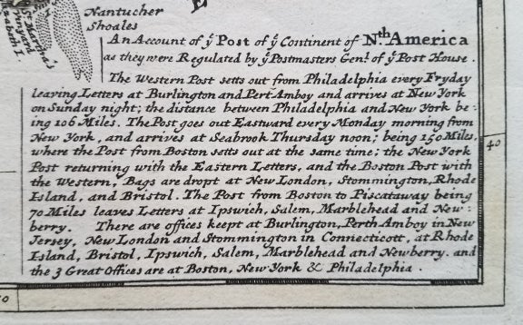
The most interesting feature of the map is the description of the colonial postal system that appears in the lower right corner of the map. The note describes the postal routes, the time of dispatch and the location of post offices. For example, "The Post goes out Eastward every Monday morning from New York, and arrives at Seabrook Thursday noon; being 150 miles...."
References: McCorkle, New England in Early Printed Maps, 1513-1800: 729.2. David Rumsey Map Collection: List no. 5580.049.
[Item no. 7752.].
Price: $2,250.00