


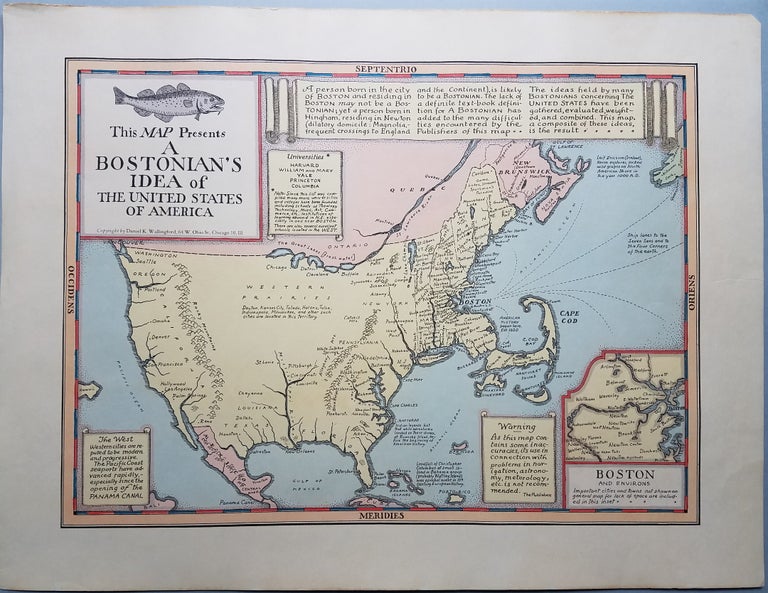
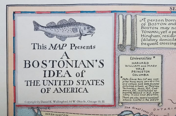
This Map Presents a Bostonian's Idea of the United States of America.
Chicago, IL: Privately published (?), 1937 or later. Image area: 12 x 16 1/2." Sheet size: 15 x 19 1/2." Excellent color, very minor edge wear and a tiny loss of paper at upper right tip. Very good. Item #3762
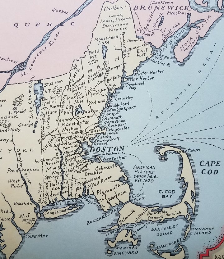
This map is a prime example of satiric cartography as practiced by Daniel Wallingford. Together with a companion map, A New Yorker's Idea of the United States of America, Wallingford gently skewered the chauvinism of the inhabitants of Boston and New York. In this map, an out-sized New England dominates the rest of the country, which is presented in a vague and geographically-challenged manner. Satiric remarks on the definition of a Bostonian, on universities and on "The West" reinforce the Bostonians' supposed high opinion of themselves.
In his article titled "Pictorial Cartography" in the IMCOS Journal for Winter, 2016, Curtis Bird provided this description of the genre which Wallingford helped advance: "One pictorial sub-genre that gained momentum in the late 1920s could be called the 'perspective-as-seen-by' maps, where regional prejudices and preferences warped the map to reflect how people thought about themselves and their nation. Done in a tongue-in-cheek style, full of puns, the land mass was inflated and diminished to show regional sentiments."
Both Wallingford maps build on the concept introduced by John McCutcheon's The New Yorker's Idea of the Map of the United States that appeared in The Chicago Tribune in 1922. In McCutcheon's map, New York is portrayed as an elegant mansion, while the rest of the country serves -- on a much smaller scale -- as "the back yard;" regional specialties are depicted as part of the mansion owner's domain: New England as the schoolhouse, Detroit as the garage and the Midwest as cornfields. Nearly 40 years after the Wallingford maps, Saul Steinberg brought this genre of satiric cartography to a new audience with his celebrated New Yorker cover -- View of the World from Ninth Avenue.
Wallingford's Boston map is known in several issues, distinguishable by his addresses given in Boston, New York (2 different addresses) and Chicago. The map also appeared in color and black and white versions and in varying sizes. Unfortunately, so little is known about Wallingford's life that even the priority of the issues cannot be determined, let alone estimated date ranges.
A fun map and an early example of "perspective-as-seen-by" thematic maps.
[ICN 7725.2.].
Price: $450.00