


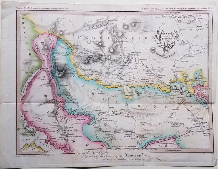
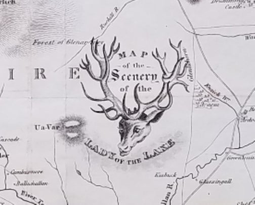
Map of the Scenery of the Lady of the Lake.
Edinburgh & London: Ballantyne and Longman, 1812. 8 ¼ x 10 ¼” plus small margins. Hand outline color. Folded as issued. Tape repair of less than 1” on reverse; remnants of mounting strips at upper edge on reverse. Good. Item #3747
This lovely small map focuses on the counties of Perthshire, Strlingshire and Dumbartonshire in Scotland, the geographic area in which Sir Walter Scott’s Lady of the lake was set. The map was drawn by Revd. Wm. Stirling and engraved by D. Lizars.
The dedication at the lower center margin of the map states: “To Walter Scott Esquire, This Map of the Scenery of the Lady of the Lake is most respectfully inscribed by The Publishers.” It was clearly designed for readers – and visitors to the area – to follow along geographically as the tale unfolded. In Nicola Watson’s 2006 book, The Literary Tourist: Readers and Places in Romantic and Victorian Britain, she opines that the map “must have been the first ever literary tourist map.” (To which we can only add that long-ago memorized line: “The stag at eve had drunk his fill, where danced the moon on Monan’s rill.” Unfortunately, we were unable to locate Monan’s rill on the map.)
No examples located online as of cataloging date.
[ICN 7712.].
Price: $375.00