


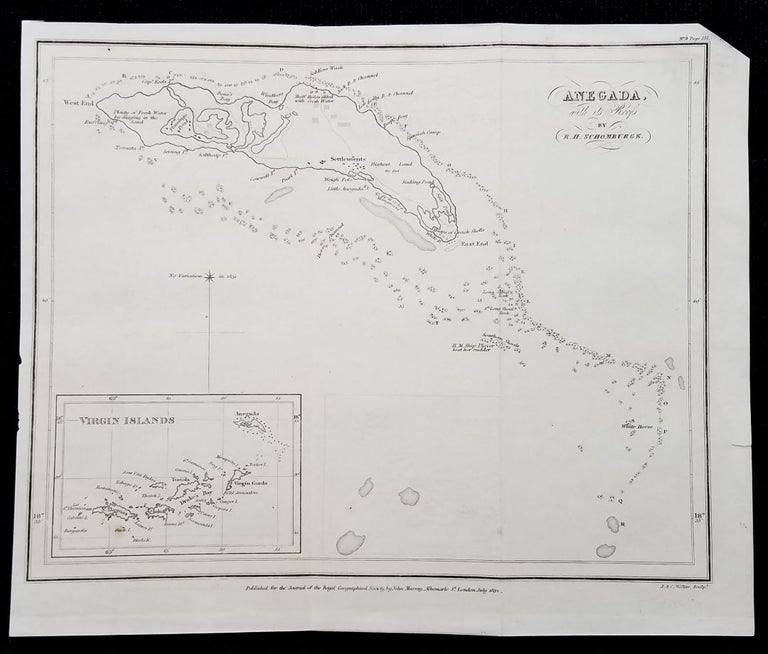
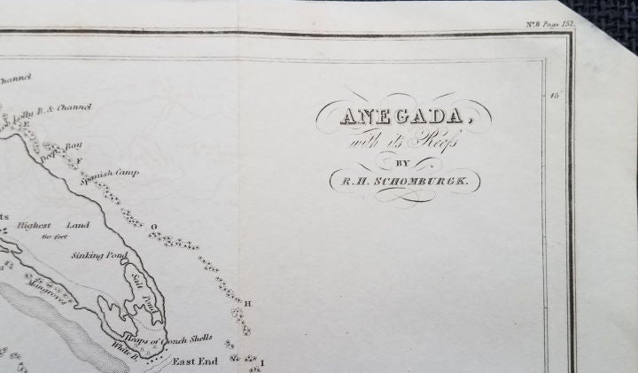
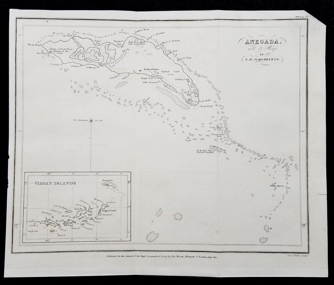
Anegada with its Reefs by R. H. Schomburgh (sic).
London: Published for the Journal of the Royal Geographical Society by John Murray. 1832. Image area: 7 5/8 x 9 ¼.” Original fold lines; light offsetting; missing the very tip of the upper right corner, not affecting image area. A pleasing copy of a charming little map. Item #3730
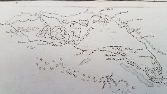
A nicely detailed map of Anegada, now one of the British Virgin Islands. Presumably this is one of the earlier separate maps of Anegada. A small inset map of the entire Virgin Islands group appears in the lower left corner of this map. Numerous points (Tomata, Saltheap, etc.) and bays (Bone's, Windlass, etc.) are identified as are Settlements, Flamingo Pond and "Heaps of Conch Shells." Various shoals, channels and locations of fresh water are also shown. At Southern Shoals, it is noted "H. M. Ship Plover lost her rudder." A charming and scarce map by the German-born and educated British explorer and surveyor, best known for "the Schomburgk line," from his survey of the boundary between British Guiana and Venezuela.
[ICN 7657.5.].
Price: $395.00