


Atlantic Local Coast Pilot -- Sub-Division 2 -- Frenchman's Bay to Isle Au Haut.
Washington, DC: Government Printing Office. 1879. Limp leather covers are lightly spotted and worn at the edges and spine. Charts and views show limited, expected light browning at the folds. Very good. Item #3724
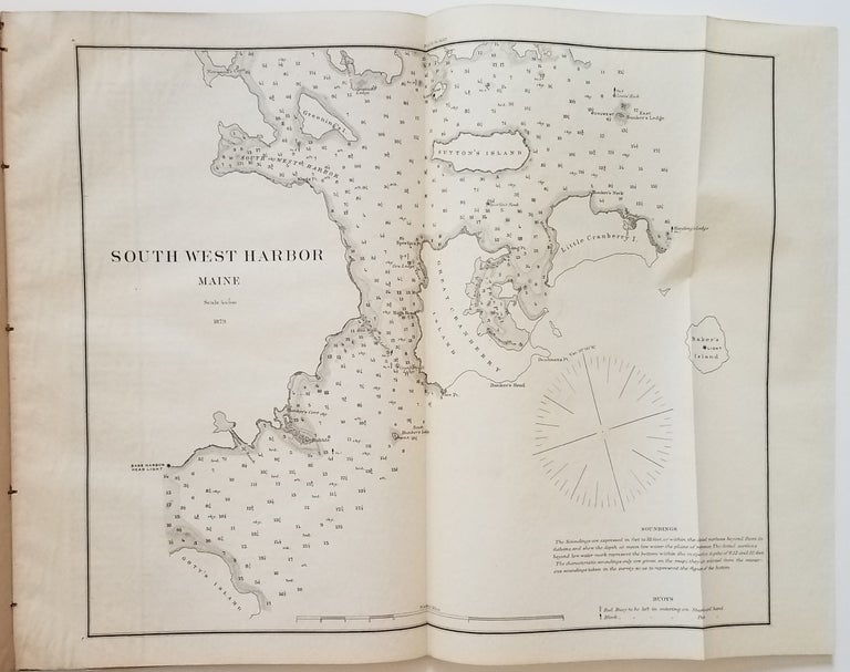
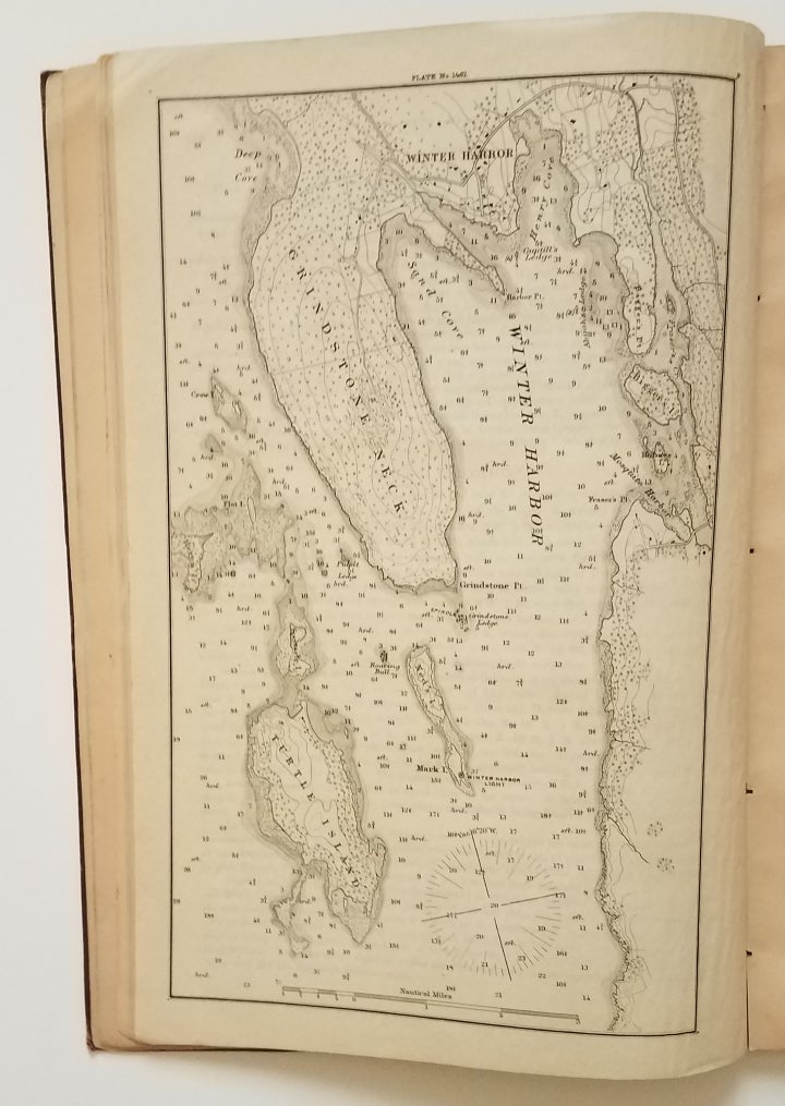
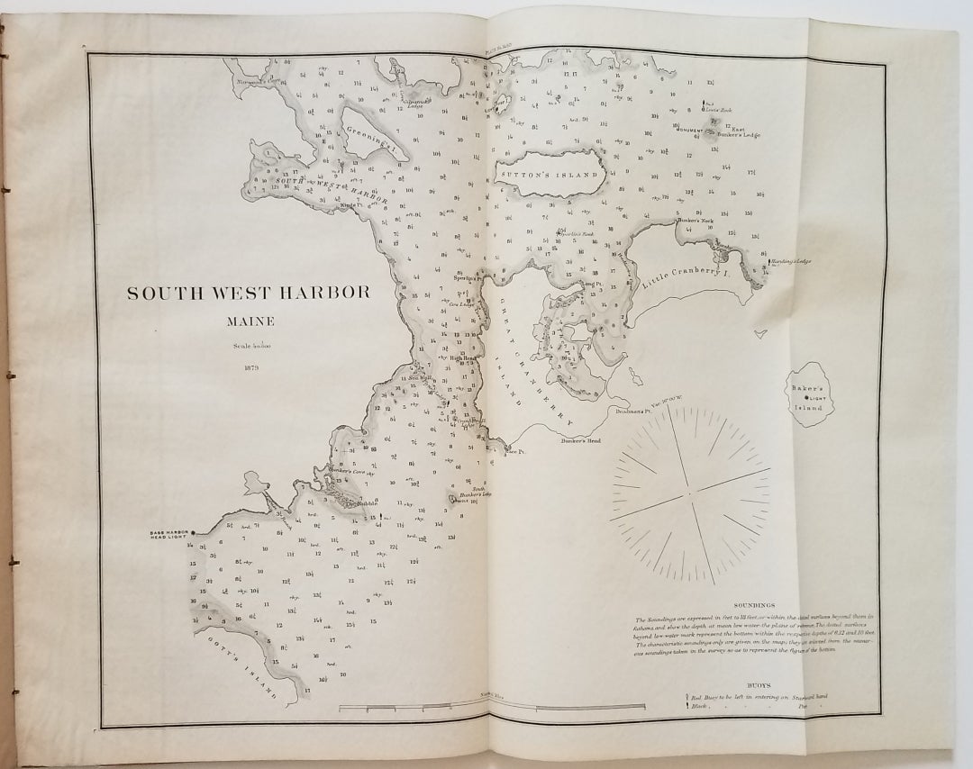
A nicely preserved example of an early U.S. Coast Survey coast pilot of the Maine's midcoast area. It contains two charts: Winter Harbor (full page) and South West Harbor (folding).
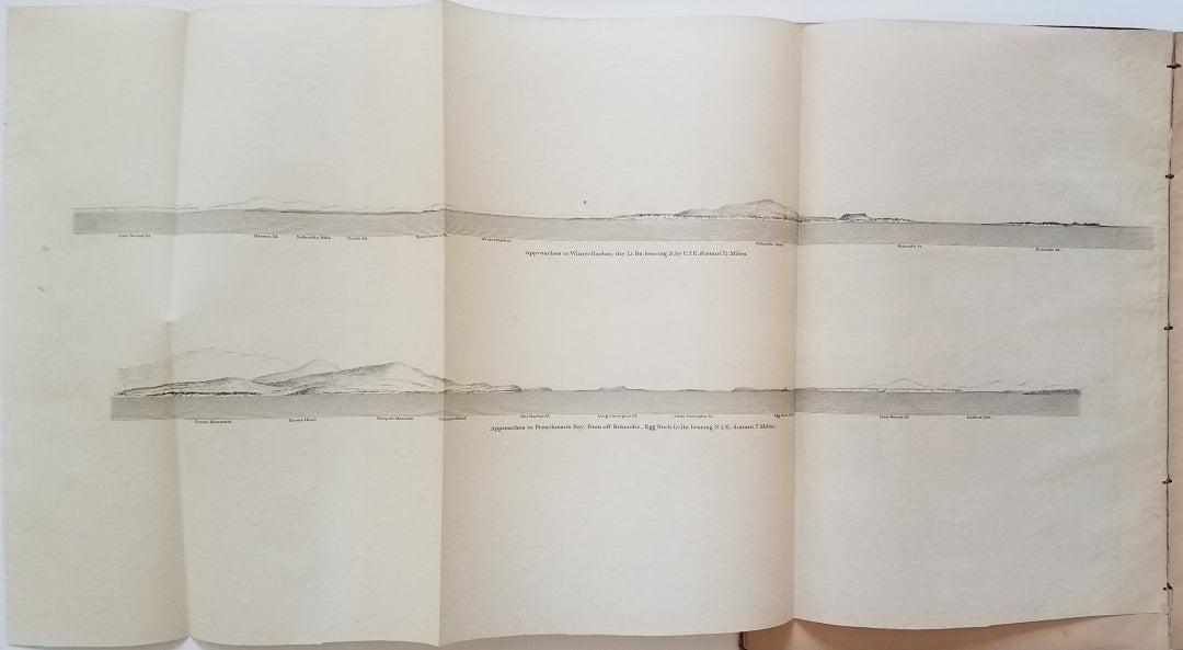
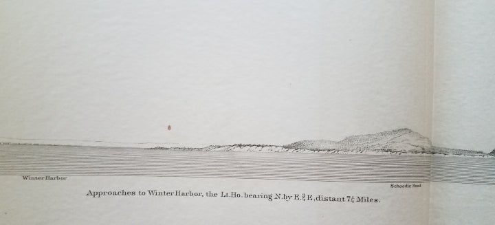
Also included are 5 fold-out pages of recognition views. Each of these pages contains between two and four separate recognition views. Among the shoreline views depicted are: Winter Harbor, Frenchman's Bay, Mount Desert, Southwest Harbor, Bass Harbor, Blue Hill Bay, Isle au Haut (2 views), Eggemoggin Reach (2 views) and Deer Island Thoroughfare (2 views). [ICN 7272.].
Price: $450.00