


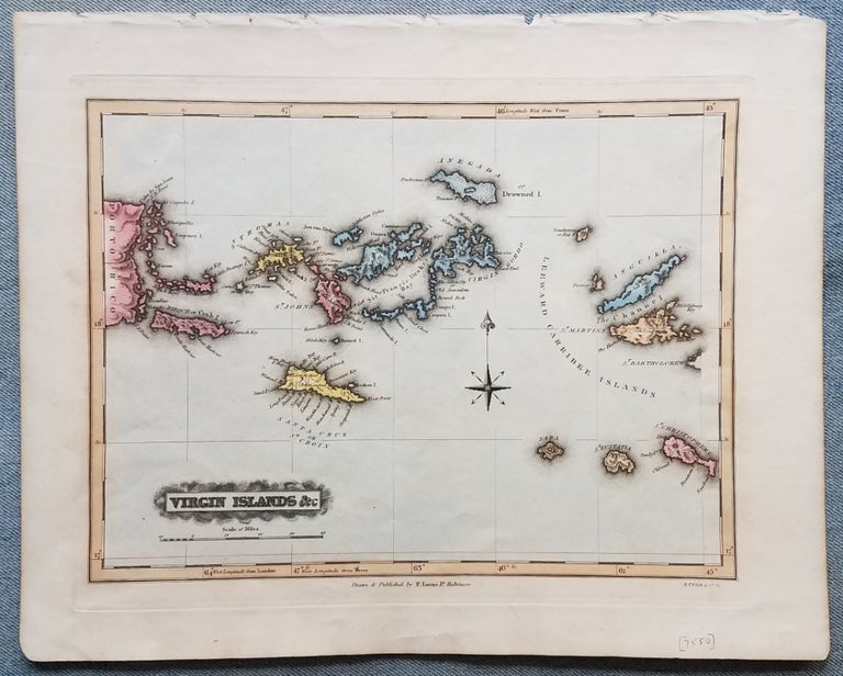
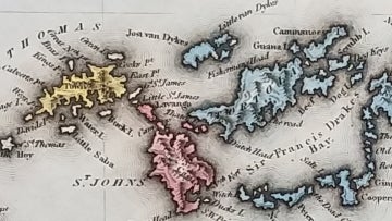
Virgin Islands &c.
Baltimore: Drawn & Published by F. Lucas Jr. Engraver.: B.T. Welch & Co., [1823.]. 9 ¼ x 12 1/8.”. Hand color. Extraction roughness at top margin, well away from the neat line. Very good. Item #3695
A wonderful example of one of the first maps of the Virgin Islands published in the United States. It appeared in Lucas’ General Atlas containing distinct maps of all the known countries in the world. The map portrays the area from the eastern portion of Puerto Rico to Anguilla, St. Martin and St. Kitts.
David Rumsey Historical Map Collection: List no. 4584.081. [ICN 7550.].
Price: $950.00
See all items in
Maps & Charts
See all items by Virgin Islands., F. Jr Lucas