


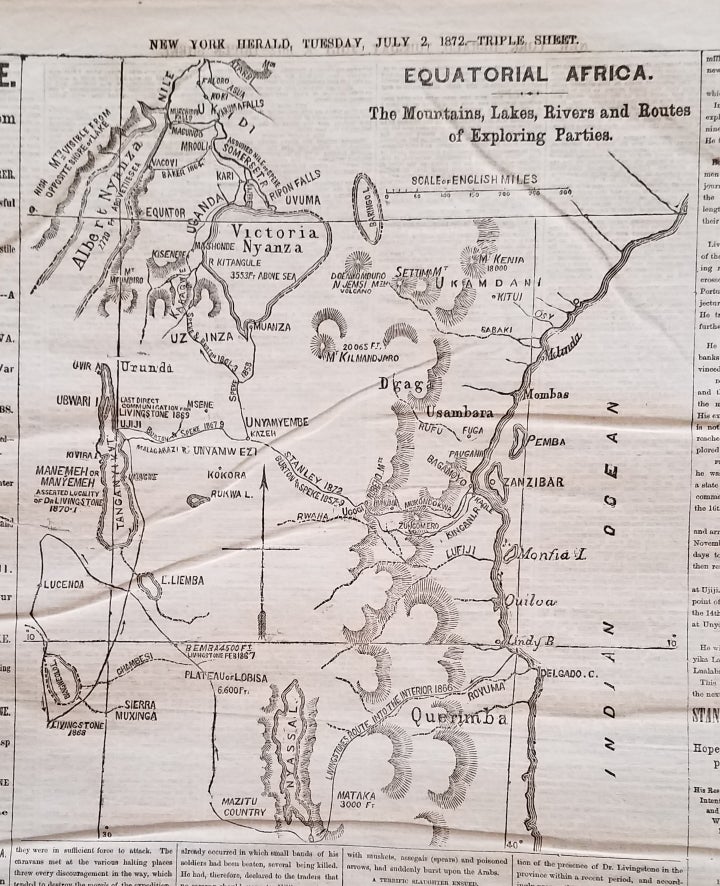
Equatorial Africa. The Mountains, Lakes, Rivers and Routes of Exploring Parties. Map appearing in the New York Herald, July 2, 1872.
New York: New York Herald, 1872. Map dimensions: 11 ¼ x 9 ½.” Newspaper sheet size: 22 x 15. Map dimensions: 11 ¼ x 9 ½.” Newspaper sheet size: 22 x 15." Newspaper disbound; roughness at spine. Overall, very good. Item #3694
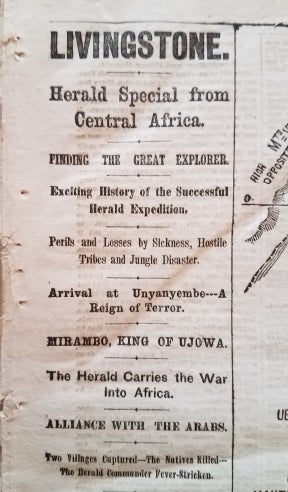
A wonderfully historic map accompanying a long story in the New York Herald recounting the newspaper-sponsored search for Dr. Livingstone. The headlines for the story are memorable: “LIVINGSTONE. / Herald Special from Central Africa. / Finding the Great Explorer. / Exciting History of the Successful Herald Expedition…”
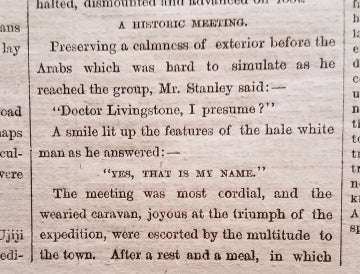
The New York Herald financed Henry Morton Stanley’s expedition to locate the famed (and presumed-deceased) David Livingstone. This is the original report of Stanley's successful search for and historic meeting with Livingstone.
The map of part of central Africa includes Lake Tanganyika, near which the legendary meeting of Stanley and Livingstone occurred in November, 1871. [ICN 7634.2.].
Price: $500.00