


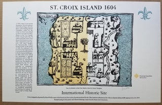
St. Croix Island 1604.
[Eastport, ME]: The Tides Institute & Museum of Arts, 2010. Sheet size: 14 x 22.” Map dimensions: about 10 x 13.” Printed on heavy stock. Fine. This striking 2010 map of the 1604 settlement on the island of St. Croix off Calais, Maine was designed and printed by..... More