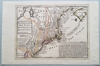
New England, New York, New Jersey, and Pensilvania. By H. Moll Geographer.
[London.]: From Moll's Atlas Minor, 1729 or later. 7 7/8 x 10 3/4." A wonderful early portrayal of the present-day northeastern United States from Grand Manan Island to the Delaware Bay. It is an updated and slightly larger version of Moll's 1708 map of the same title. Cape Cod is..... More