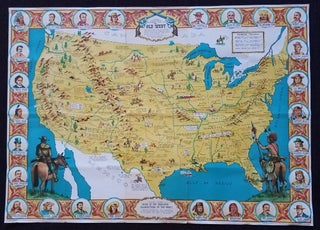
Sheriff Danny Arnold's Pictorial Map of The Old West showing pioneer trails and battles, Indian's territories, stagecoach lines, military forts, historical data of the frontier period around 1840.
London: Published and Copyrighted by the Old Western Trading Post Limited, Printed in Great Britain. Ca. 1960s. This colorful pictorial map captures the lore of the Old West. The map features prominent pioneer trails such as the Oregon Trail, the Santa Fe Trail and the Pony Express route. Among the..... More